Jarvis
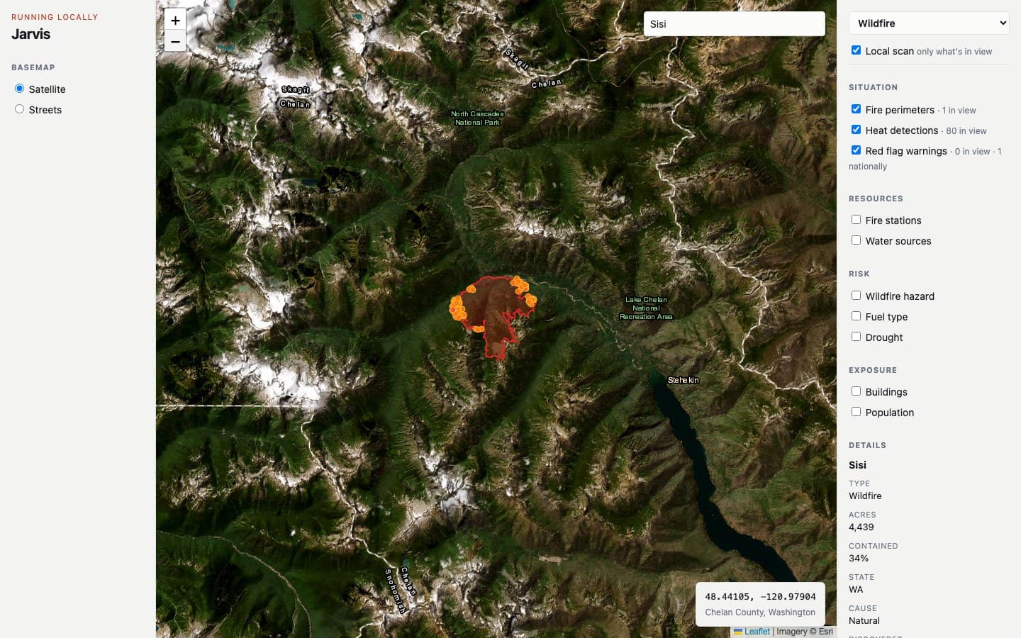
Jarvis is a five person CU Boulder capstone with a big goal: learn from hundreds of past disasters and estimate how a given city would fare in the next one. That model isn't built yet. What runs today is the part I built: a wildfire map with 10 layers pulled live from 7 public sources, a click anywhere fuel, weather and drought report, and a pipeline that loads teammates' spreadsheets into Postgres straight from GitHub.
Period
- Sep 2026 – present
Role
- Full stack, team of five
Type
- Source on GitHub
Tools
The idea
Jarvis is my senior capstone, built with four teammates. The plan is a model that learns from past disasters and estimates what the next one would cost a city in people and money, so officials and first responders can plan before it hits. We're starting with wildfire. My teammates are on the research, the data sources and the model; I built the parts that run today.
What runs today
The map is Leaflet and plain JavaScript, served by a small FastAPI app. It pulls 10 layers live from 7 public sources: NIFC fire perimeters colored by containment, NASA VIIRS satellite heat detections, NWS red flag warnings, USGS fire and EMS stations, lakes and reservoirs as water sources, USFS wildfire hazard, building and population density, LANDFIRE fuel types, and the U.S. Drought Monitor. Click anywhere and it reports the fuel type, current weather and wind, and drought level there. Each of those lookups fails on its own, so one slow source doesn't blank the rest.
The other piece is the team's data pipeline. Teammates drop CSV or Excel files or add source links in the repo on GitHub, and a GitHub Actions job loads them into Supabase Postgres, rebuilding each table so a re-upload never duplicates rows. Nobody needs anything installed to add data. It has loaded 356 EM-DAT wildfire records as seed data for the planned model.
Not built yet
The prediction model, which is the point of the whole project, isn't built. The other hazards in the plan (earthquakes, hurricanes, tornadoes and tsunamis) are placeholders, and nothing is hosted yet, so the map only runs locally.